
Mitchell Falls is one of the iconic images of the Kimberley, and really inspired the entire trip. The amazing pictures of the rest of the area and comments from people who had been firmed up the desire. Official information can be found at https://parks.dpaw.wa.gov.au/park/mitchell-river
After a fuel stop at Drysdale River Station and a quick call home before no contact with the outside world for a few days it was onto an ungraded section of road for a few hours, before driving through lush rainforest into Mitchell Falls National Park and onto the campground. The drive in was the worst so far, lots of wash outs, sun setting directly ahead blinding us on the drive in and hills that made seeing oncoming vehicles impossible.
As had become the norm we arrived just before sunset, set up the camp for a few days and kicked back with a couple of ice cold beverages, and started a fire and bbq. On the drive in we had stopped outside the National Park to get some firewood.
We woke early the next day and headed straight to the helicopter booking office to organise a one way trip from the top back to camp. At $150 each this took a bit of thought however I can say that it was honestly the best money spent on the trip. Flights organised we grabbed our day packs and started walking through the bush.
Around half way to the Falls we stopped and had some sandwiches, jumped into a stream that was running alongside the path to cool off, and I put some more sunscreen on in the shade. After another fifteen minutes of walking we made it to Big Mertens Falls.
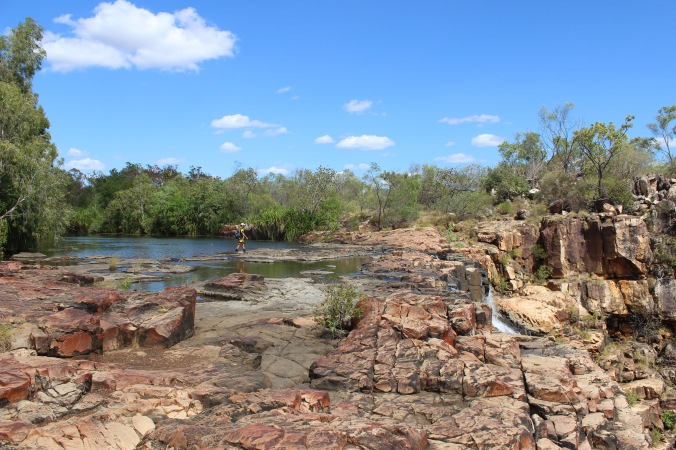 Crossing Big Mertens Falls
Crossing Big Mertens Falls was straightforward as there is a well sign posted trail, but out to our right was a drop of at least 200 feet, and one of the best views of the trip so far.
Looking into Big Mertens Falls from the crossing
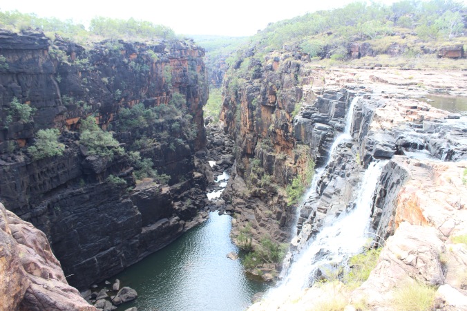
We left Big Mertens Falls and tracked on for another half an hour or so and then spotted some helicopters parked across from us. We spotted some other hikers going around to the right and followed them around for another half hour or so and found the front side of the Falls from the opposite cliffs.
View of Mitchell Falls from the cliffs
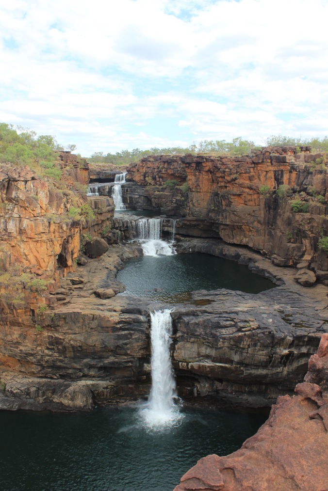
After spotting what looked like a small cave we clambered down and into a space created by an overhang for our lunch. An amazing natural lunch spot, the best view in the park and all in complete shade. Happy Days!
We took some happy snaps, found another couple of spots to clamber down and get some photos and then went back to the top of the Falls. At the top is the only place that you can go for a dip, and is possibly the best spot. Up here are some natural whirlpools and the temperature is just right to cool off after all the walking in the 30C+ weather. After about an hour of doing very little we went to the chopper. Que the Arnie quote…
After a safety briefing from the pilot and a quick discussion about using a seat belt we were up in the air. The briefing clearly told us not to put our bodies out of the doorways. I dare anyone who is in this position not to. We had a camera out of each doorway and were snapping like the tourists we were for the entire six minute flight.

Big Mertens and Mitchell Falls from the air
The best part of the flight was that we were clean, dry, and dust free! A big deal in this part of the world, at least it was until we got back to the campground and had to jump off the chopper.
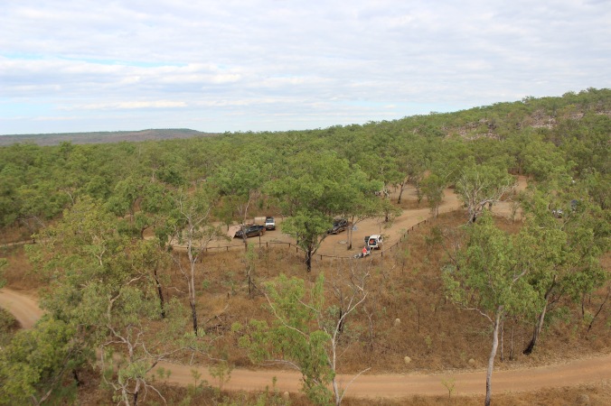
Mitchell Falls campground as we were landing
That night we met one of the more interesting characters on the trip who was a professional 4WD’er and adventure photographer. He had worked on oil rigs and as a pilot before his current gig and gave us some really good tips on campgrounds and joined us around our fire for a chat and a few bevvies.
After hiking down to the bottom of the Falls we went for a swim for an hour or so, we were the only people here for at least half of that. The next morning we went to Little Mertens Falls to find some aboriginal drawings and to clean off before leaving and heading back to the Gibb.


The drawings were amazing and hidden in a cave above the waterfalls, although some filthy people had left rubbish and worse behind. We decided that the cave must have a way out at both sides which led to about an hour of scrambling up and over boulders and rocks until we found a series of rocks that could be used to haul yourself out and back to the top of the Falls. A quick hike out and we were back on the road to Drysdale Station and a call home from a phone box inside of a fridge. After filling up we went back on the road and off to the next spot.
